Projects
Integrating Statistical with Physically Based Methods in Anomaly Detection of Environmental Time Series Data
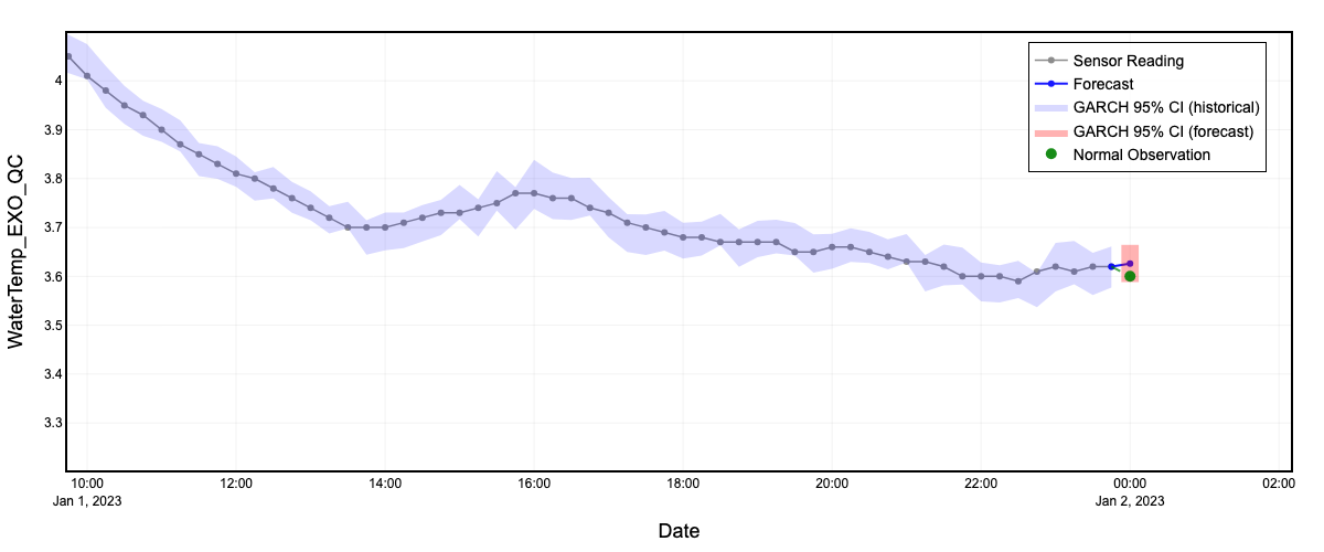
This project explores a hybrid approach that combines statistical algorithms with physically based models to improve the detection of anomalies in environmental sensor time series. By aligning data-driven insights with known physical processes, the method enhances the reliability of anomaly detection, particularly for identifying sensor drift, calibration errors, and outliers in environmental datasets.
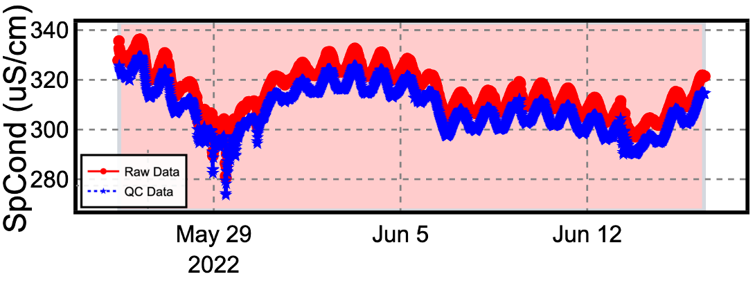
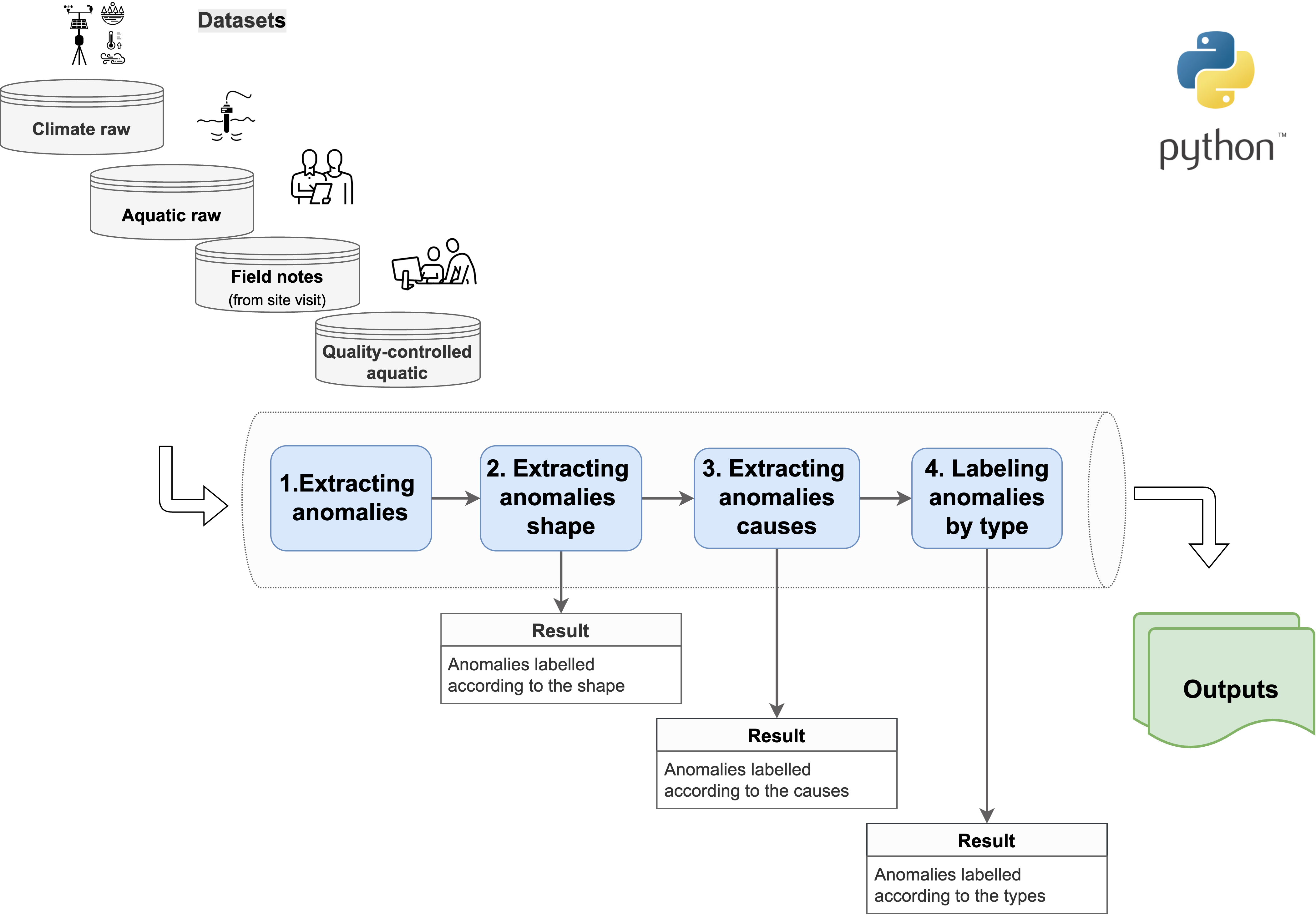
Developing Standardized Benchmark Datasets for Testing Automated Quality Control Algorithm Performance for Environmental Sensor Data
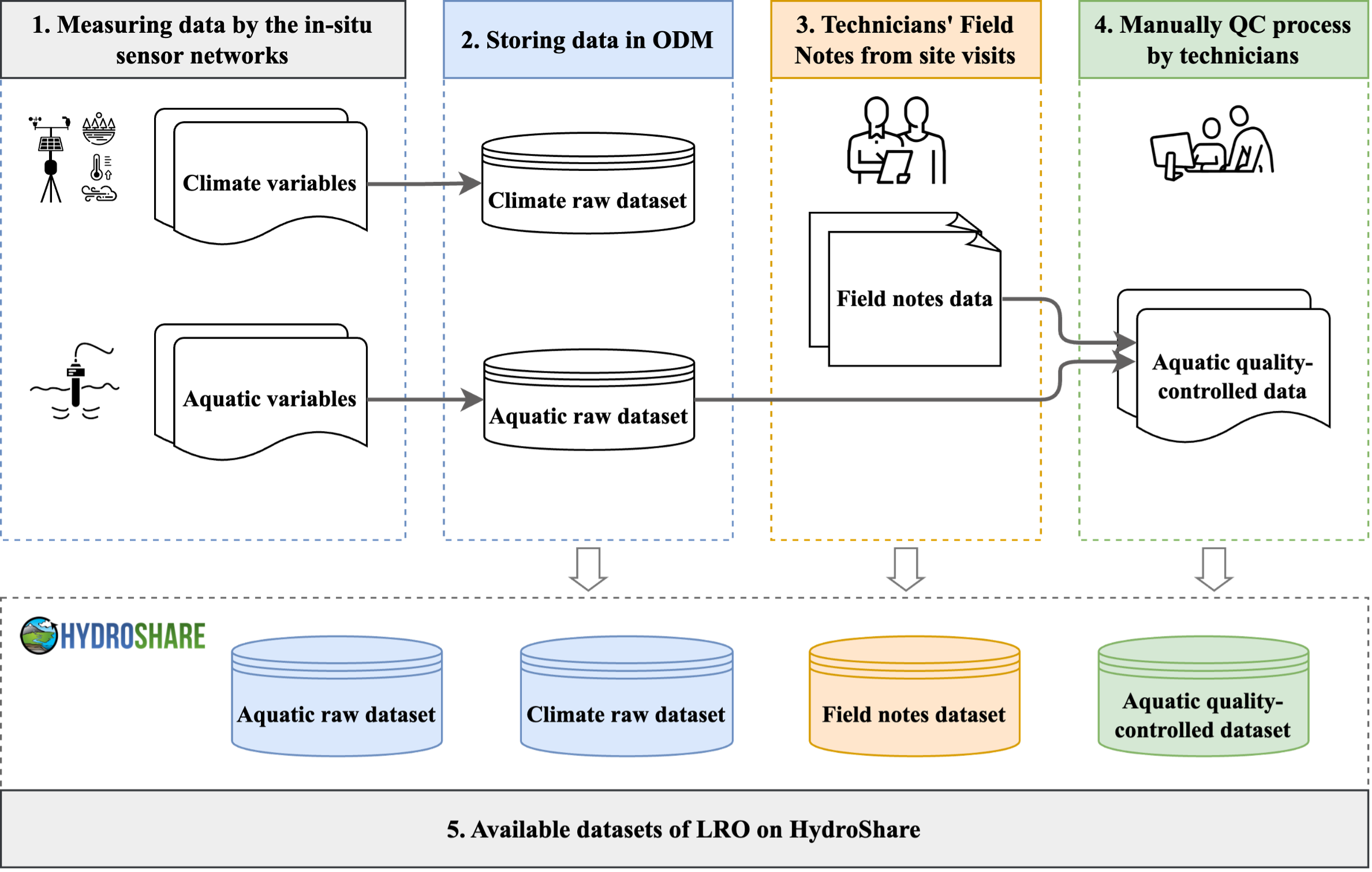
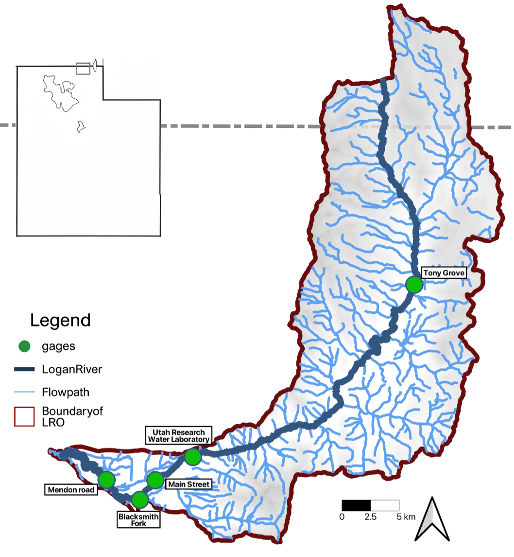
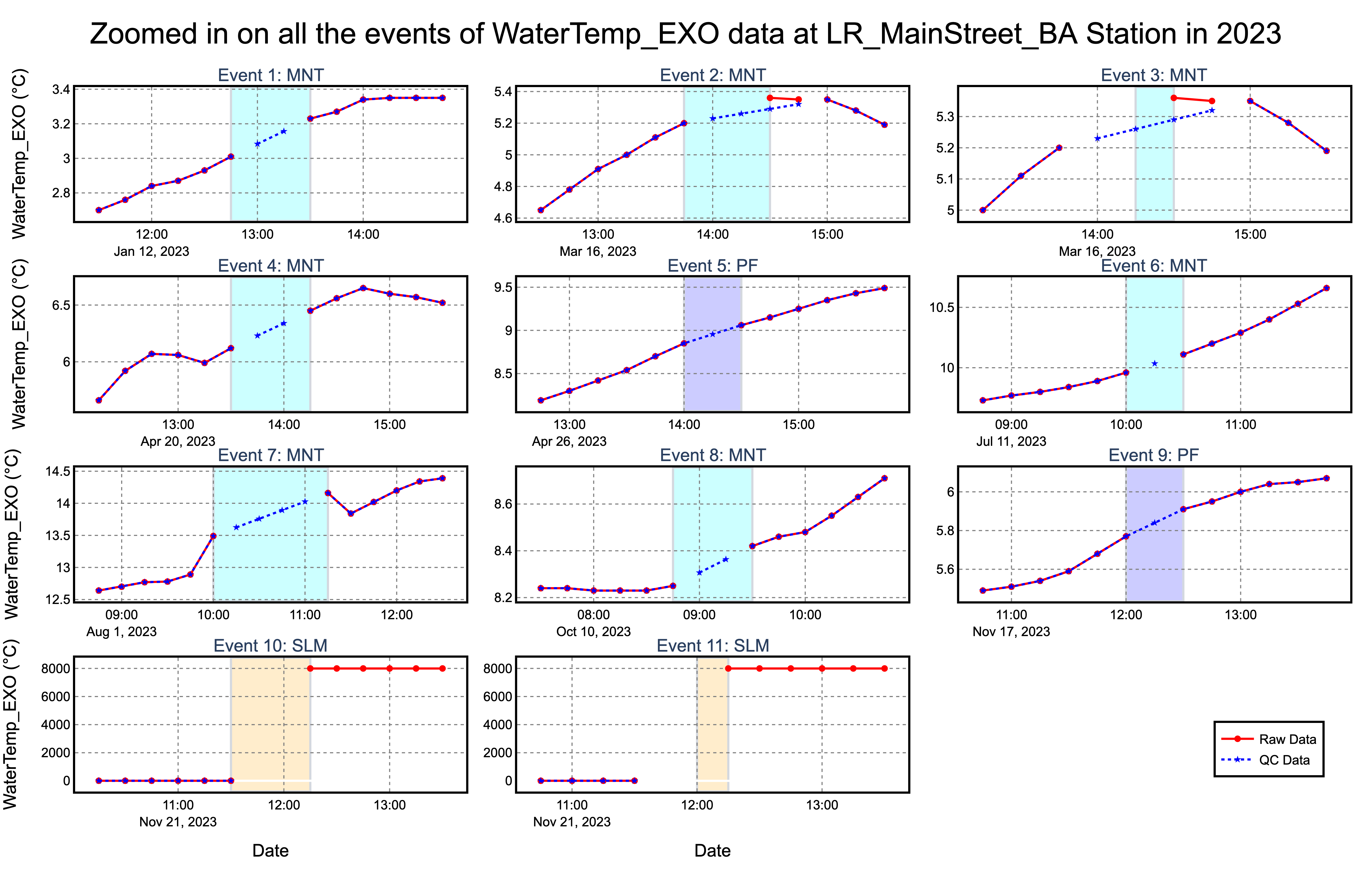
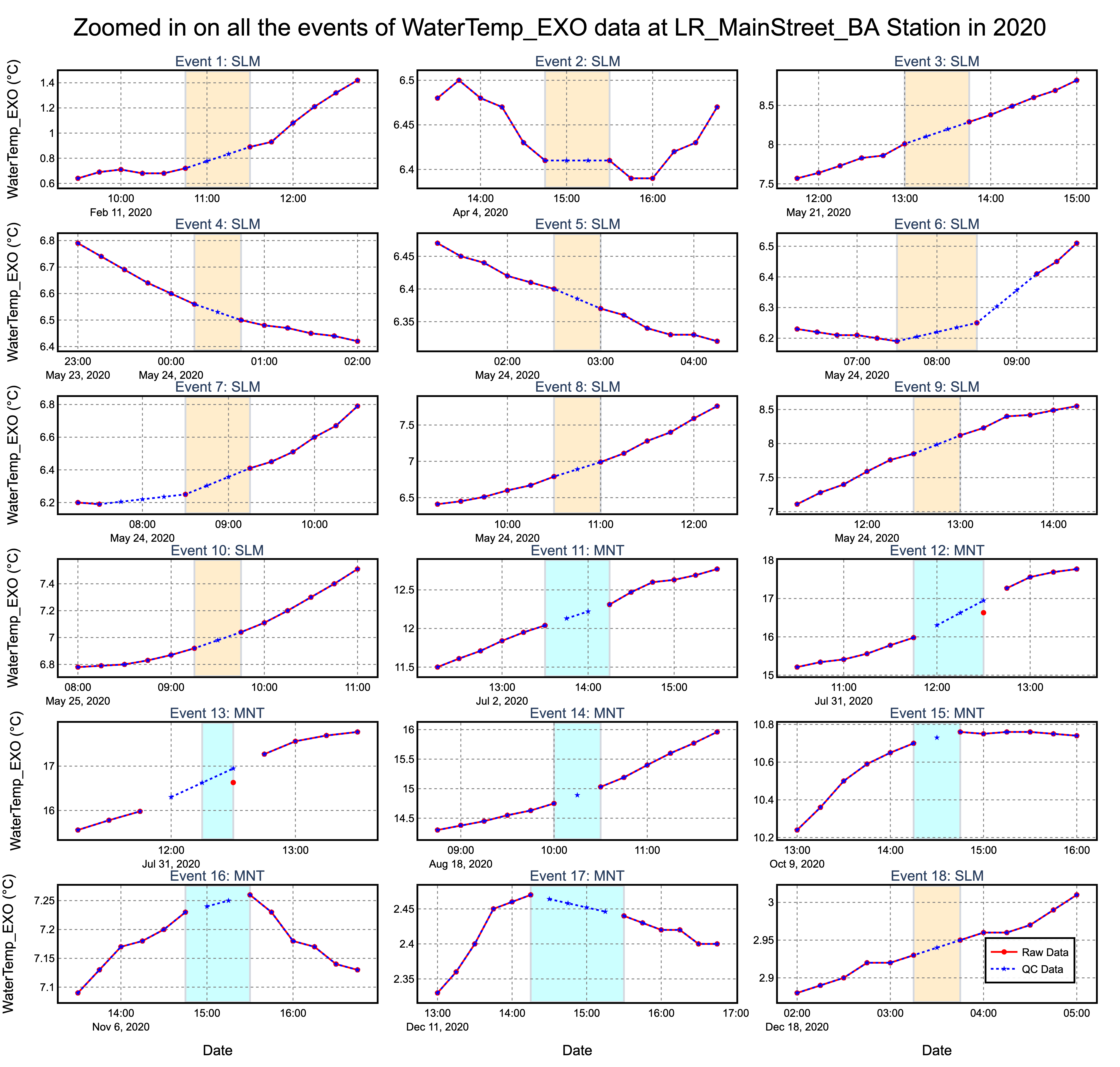
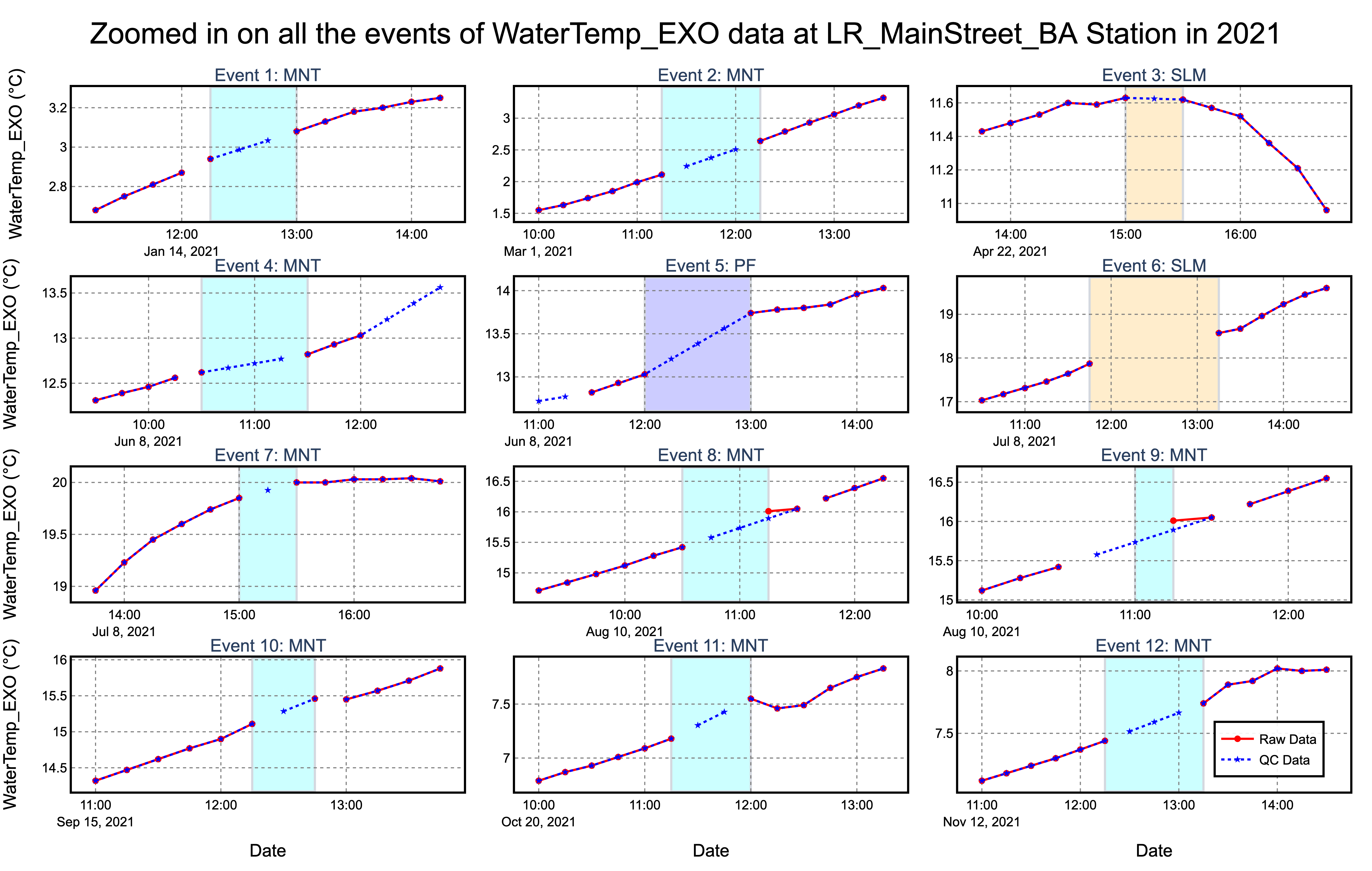
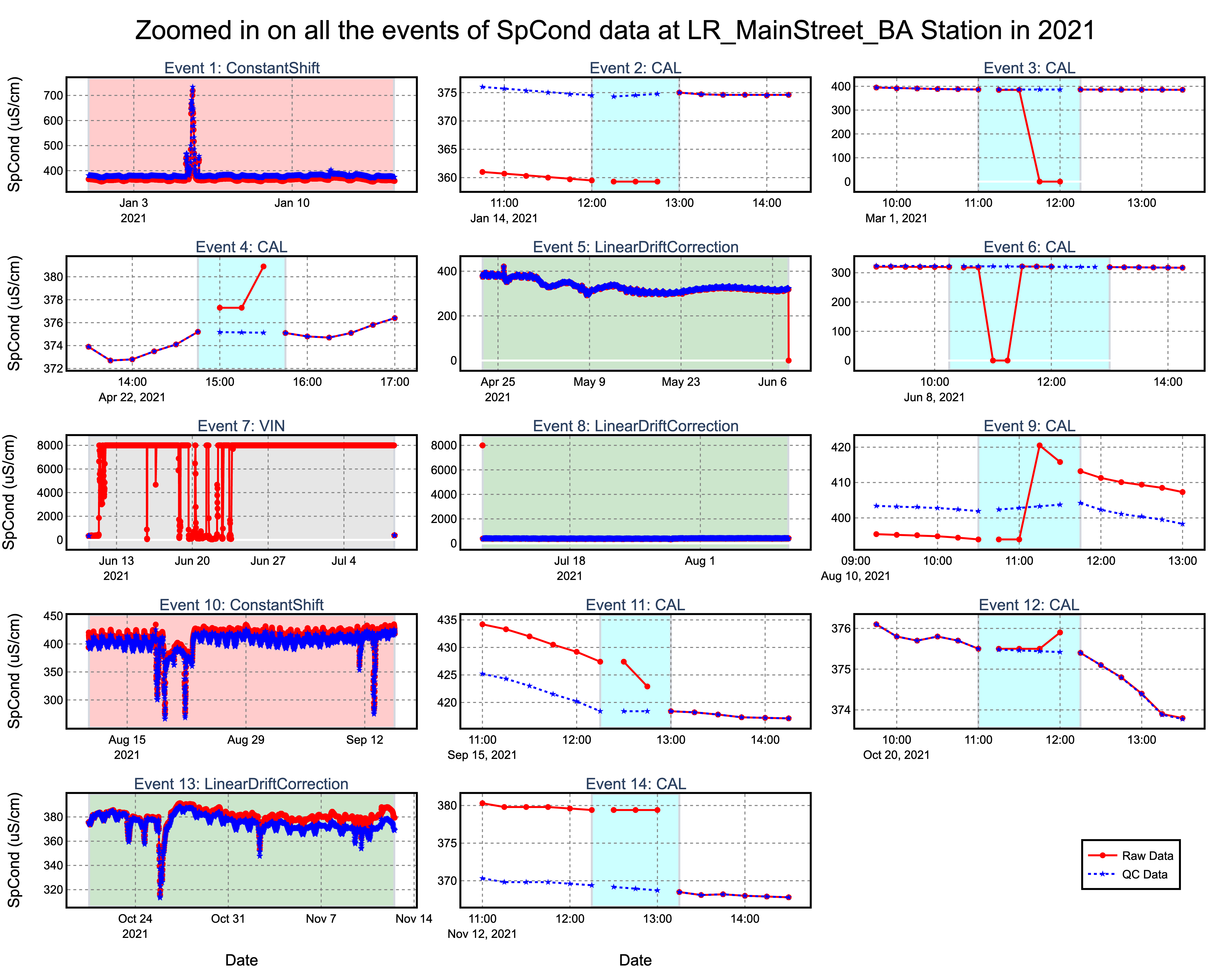
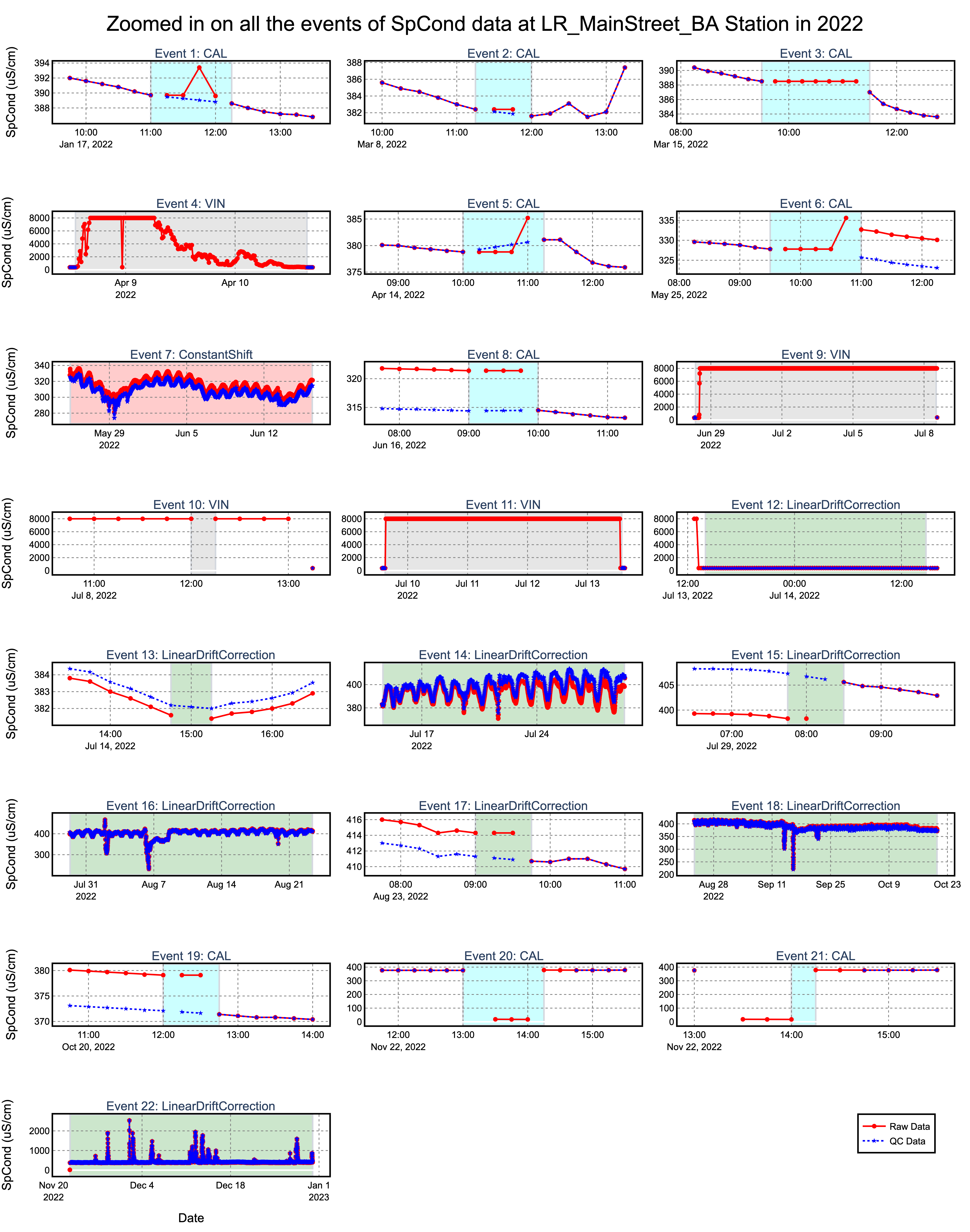
Utah State University, USA (2023–Current)
This project addresses the need for effective, scalable automated quality control (QC) methods in environmental sensor networks. Using in-situ sensor data from the Logan River Observatory, we developed standardized benchmark datasets by identifying, categorizing, and labeling anomalies in raw and manually corrected time series. A reproducible Python-based workflow was created to support the generation of benchmark datasets from other sites as well. These benchmarks enable systematic comparison of automated QC algorithms under diverse hydrologic conditions and anomaly types, significantly advancing the evaluation and reliability of machine learning and statistical QC approaches.
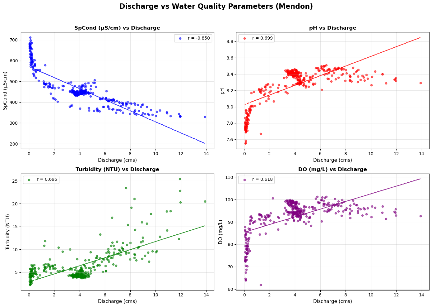
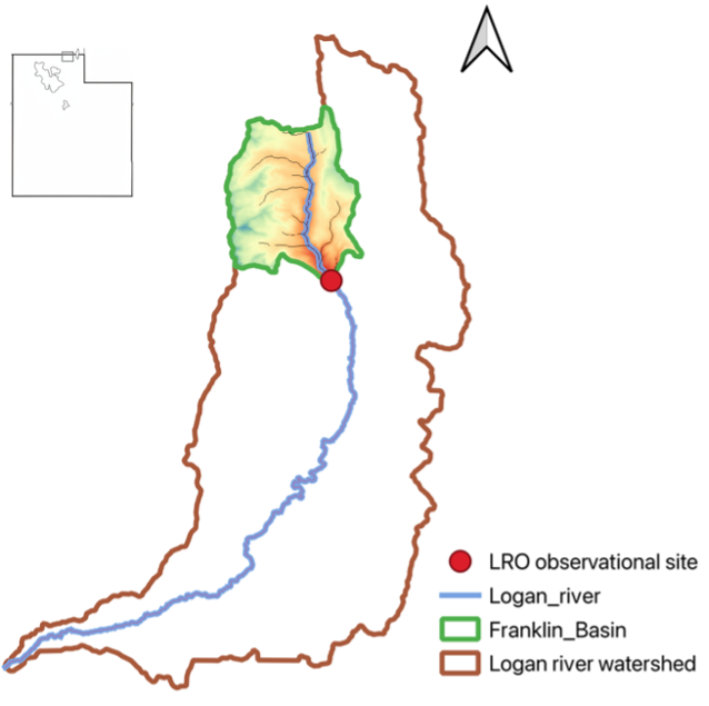
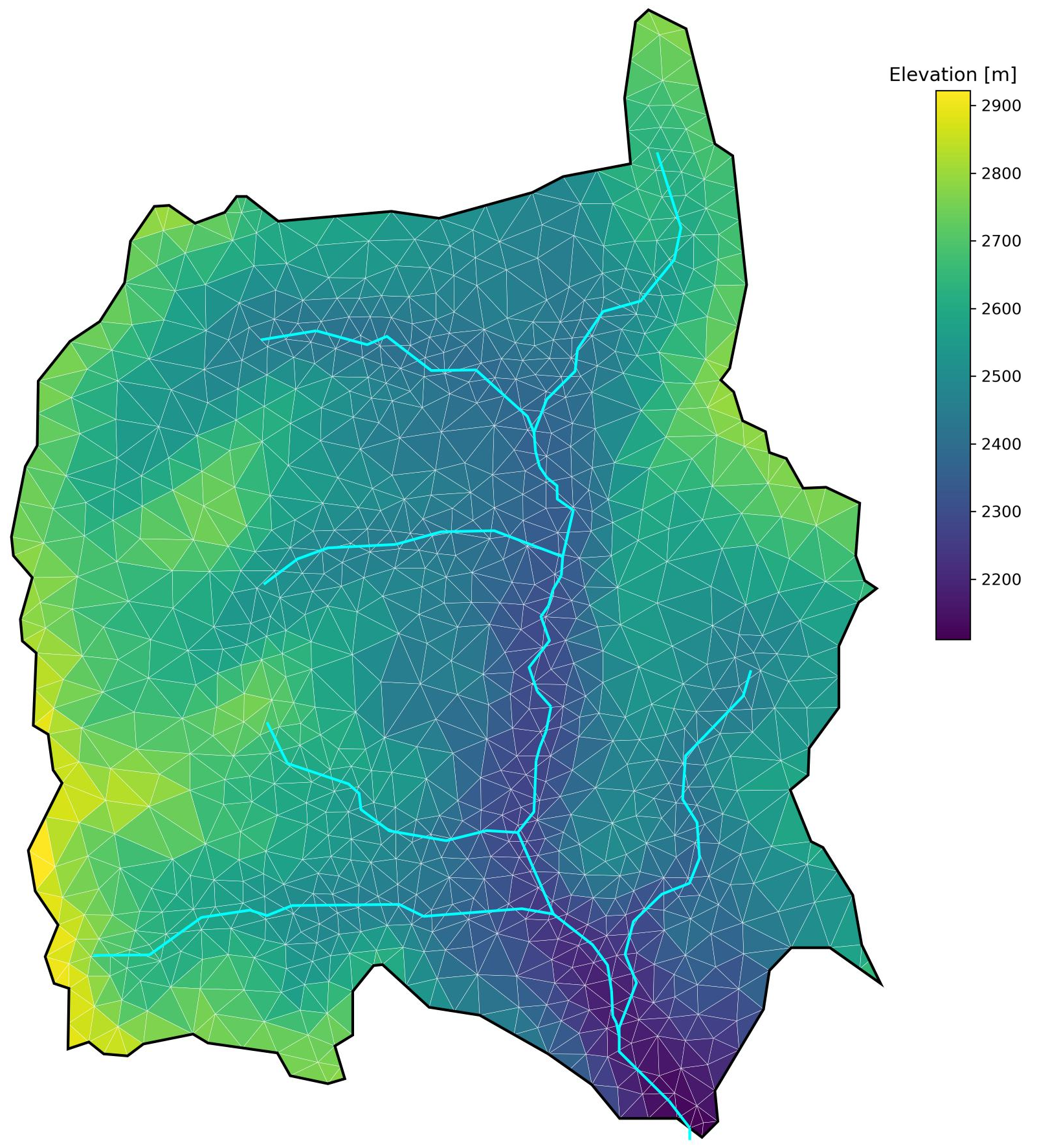
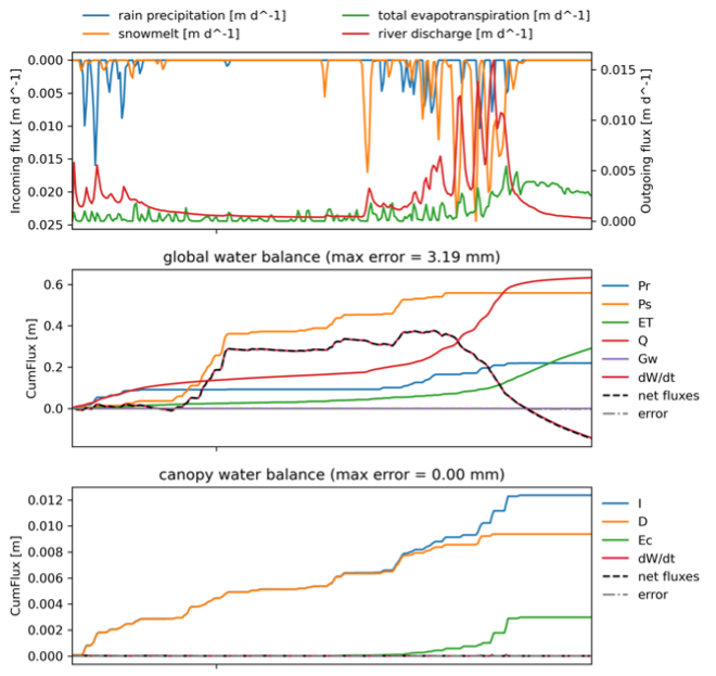
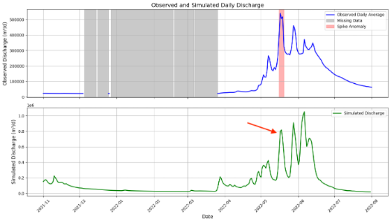
Assessing the Potential of Integrating Hydrological Modelling Outputs with In-situ Sensor Datasets to Improve Anomaly Detection of Streamflow Data
Utah State University, USA (2025)
This project evaluates the integration of hydrological modeling outputs with in-situ sensor datasets from the Logan River Observatory to enhance anomaly detection in streamflow records. Using the Advanced Terrestrial Simulator (ATS), a detailed simulation of the Franklin sub-watershed was conducted, capturing key seasonal flow patterns. The results demonstrate that hydrologic simulations can help identify sensor-induced anomalies, validate observed streamflow, and fill data gaps. This approach shows strong potential for improving the quality control of environmental sensor networks and supporting more reliable hydrological forecasting and watershed management.
Site Visit Assistant App for Efficient Environmental Monitoring, iOS
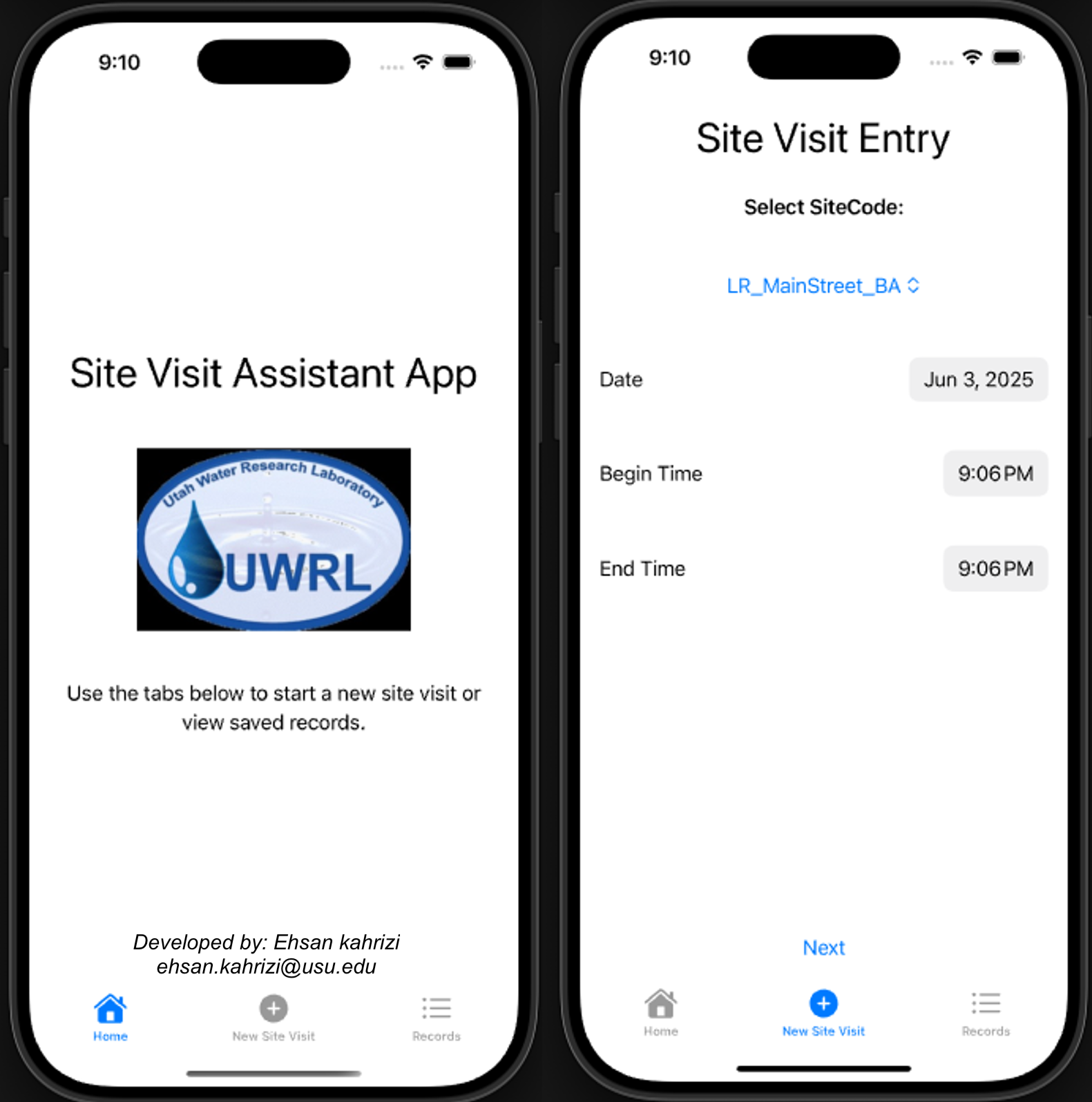
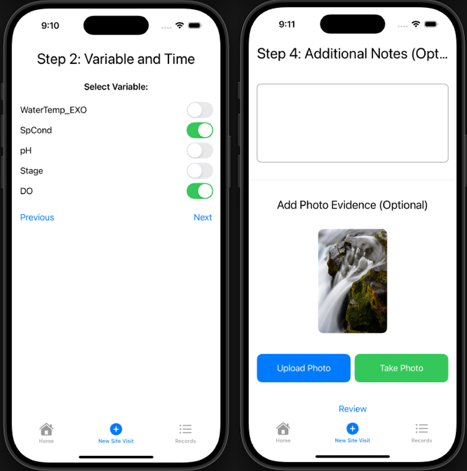
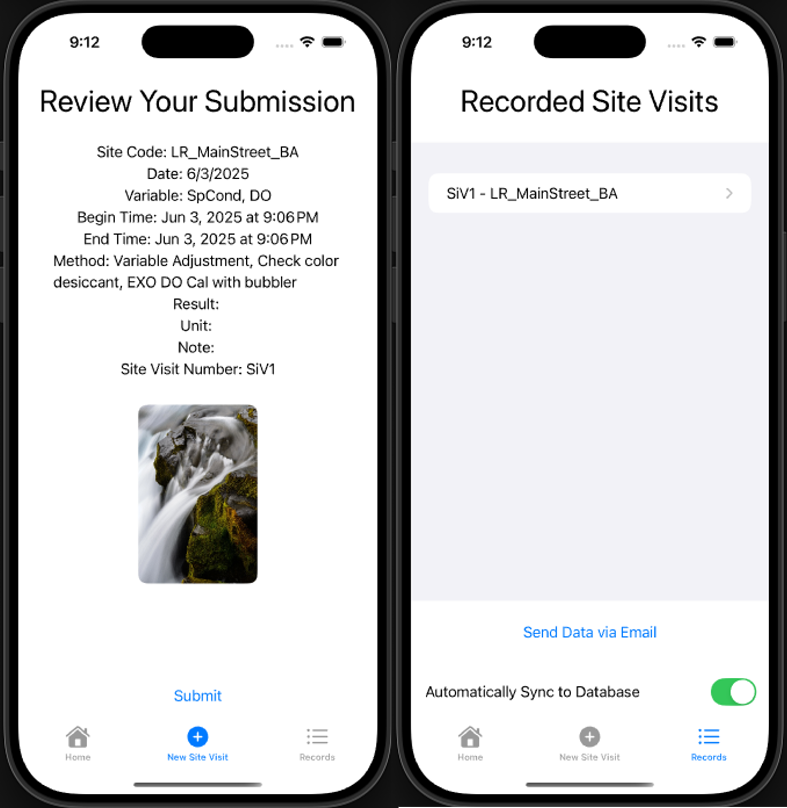
The Site Visit Assistant App streamlines data collection and reporting for maintenance technicians conducting environmental monitoring at field sites. Designed with an intuitive interface, the app enables quick entry of site information, including date, time, selected variables (e.g., temperature, dissolved oxygen, specific conductivity), and method notes. Users can effortlessly attach photo evidence directly from the field, review collected data clearly, and securely store site visit records. Additionally, the app supports convenient data export via email and automatic synchronization to databases, significantly enhancing workflow efficiency and accuracy for technicians and researchers at environmental research facilities.
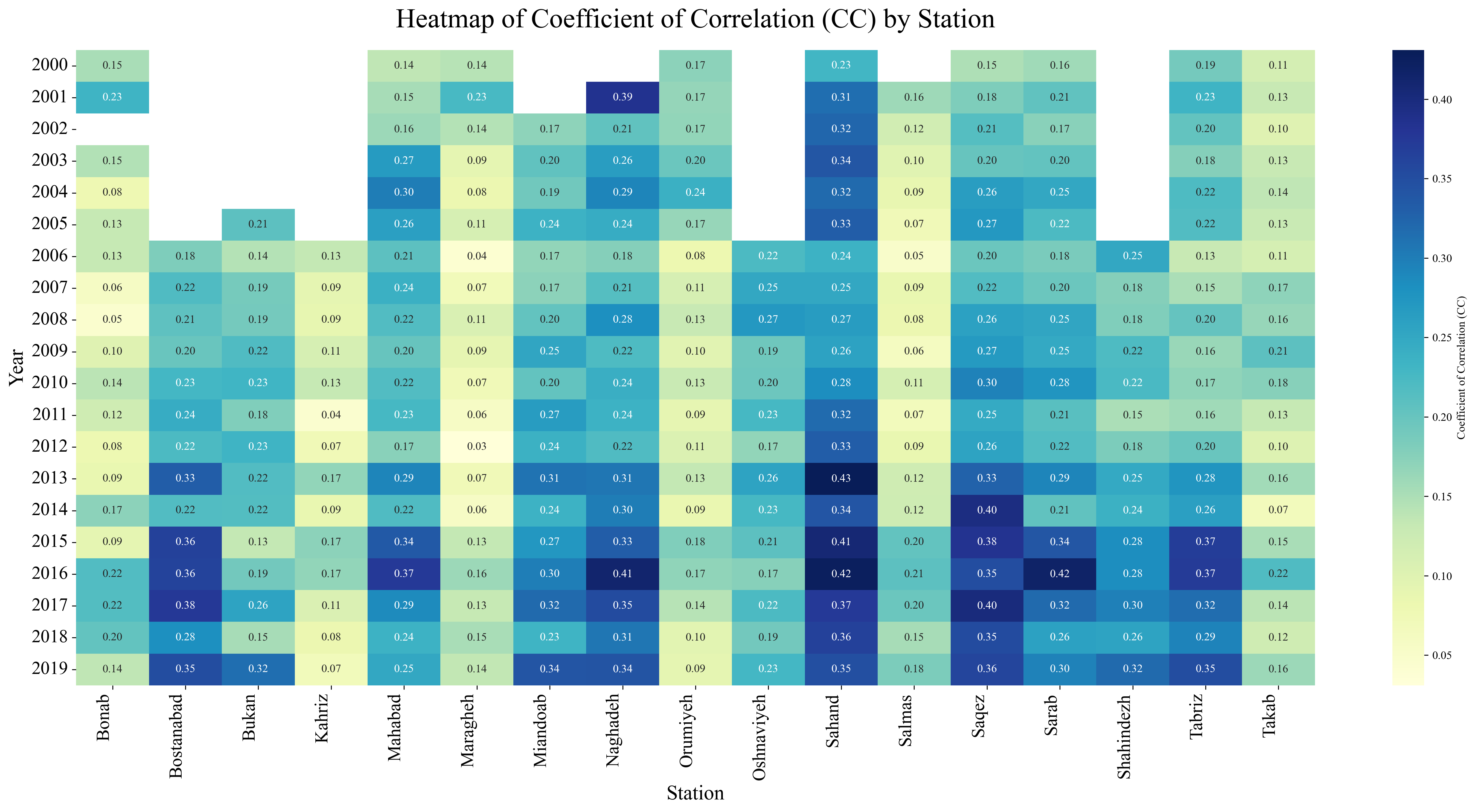
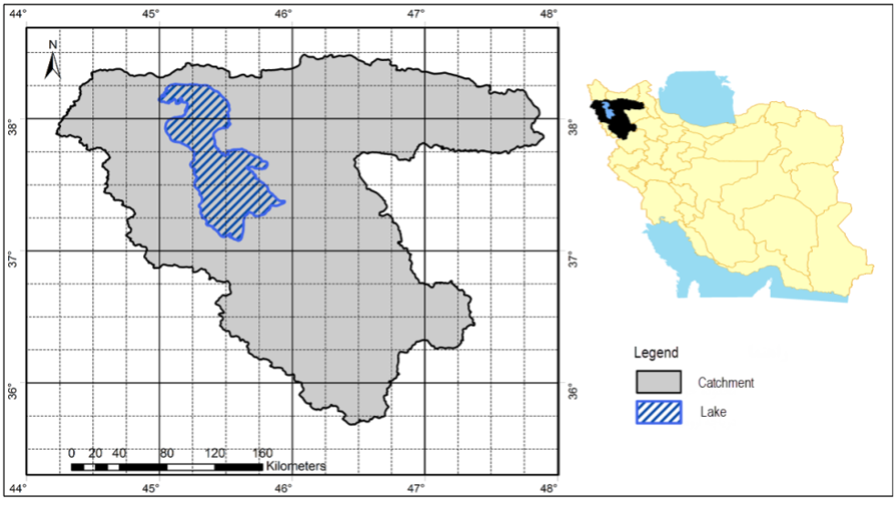
Evaluating Meteorological Data from Weather Stations, Satellites, and Forcing Datasets for Urmia Lake Basin
Tarbiat Modares University, Iran (2022)
This project aims to evaluate the accuracy and applicability of the GLDAS global dataset by comparing it with ground-based meteorological station data across the Urmia Lake Basin in Iran. Key variables such as wind speed, temperature, pressure, humidity, and precipitation were analyzed across 17 in situ stations. The results indicate spatial and temporal inconsistencies in GLDAS outputs, often underestimating or overestimating values depending on station location and variable type. The project highlights the need for local calibration of global datasets to improve the reliability of hydrological and climate modeling in semi-arid regions like Urmia.
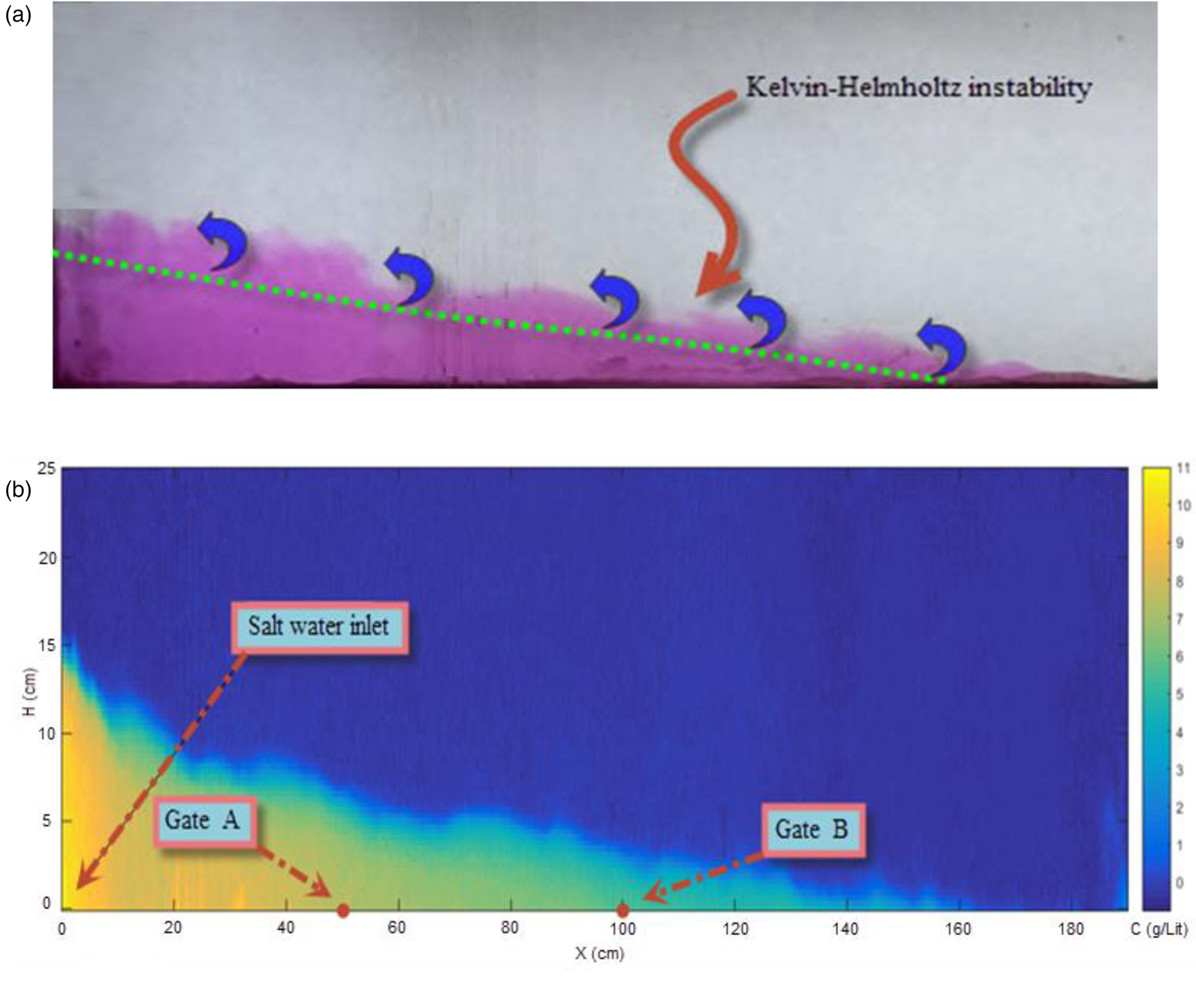
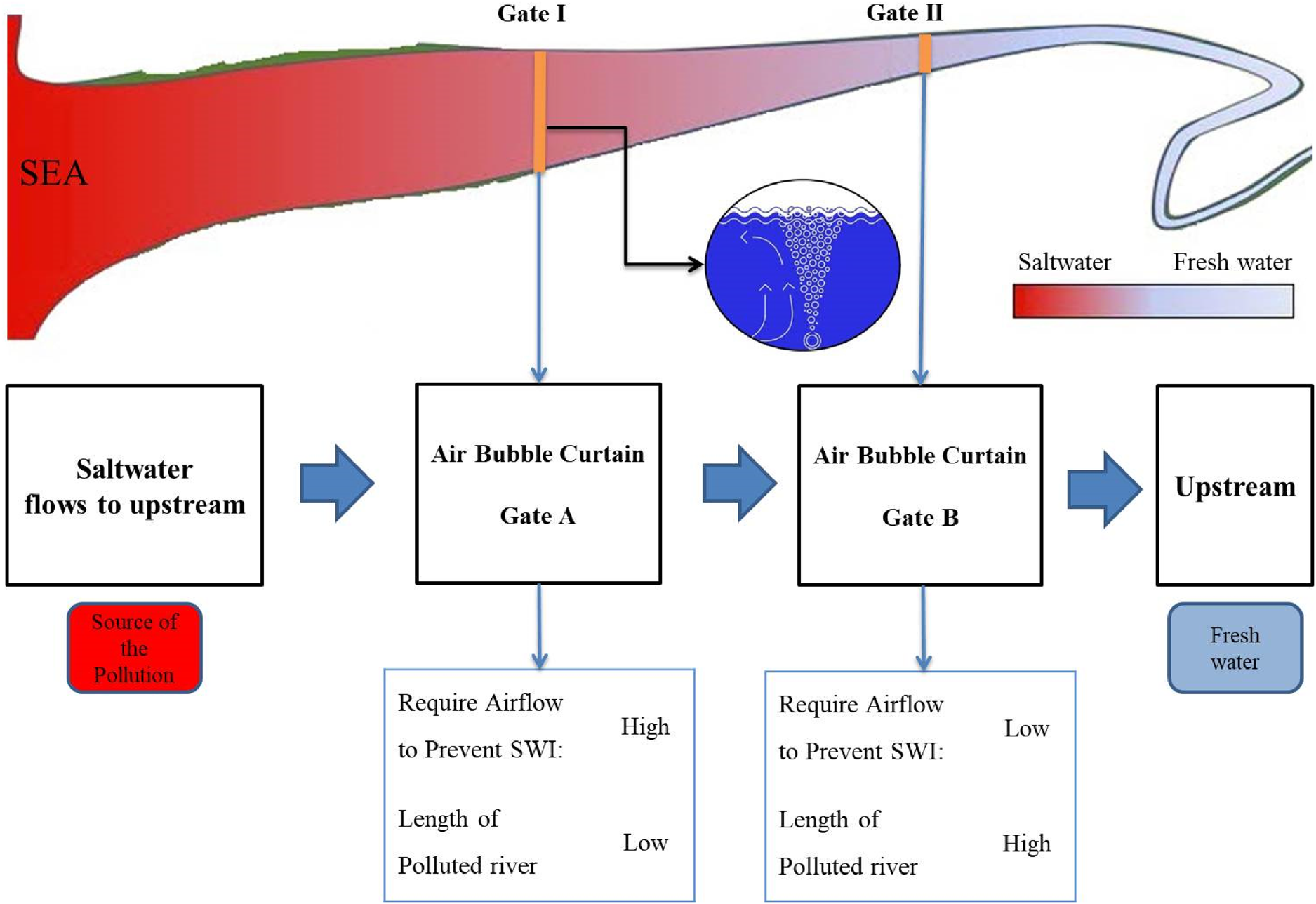
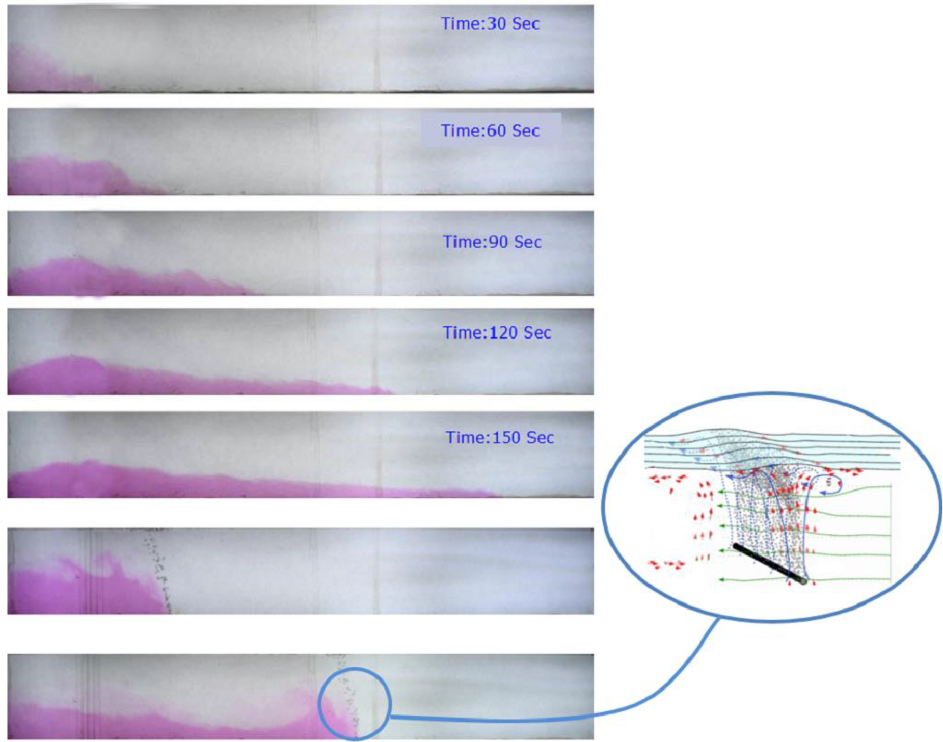
Investigation of Air Bubble Curtain to Prevent Seawater Intrusion
Tarbiat Modares University, Iran (2019)
This project investigates the potential application of the air bubble curtain (ABC) method to mitigate seawater intrusion (SWI) into rivers. Using the experimental tests and image processing techniques, the effect of the ABCs was studied, and the optimal location of the ABC and the airflow were obtained. Regression equations were developed to predict SWI parameters based on flow characteristics, offering practical guidance for ABC deployment in real-world conditions.
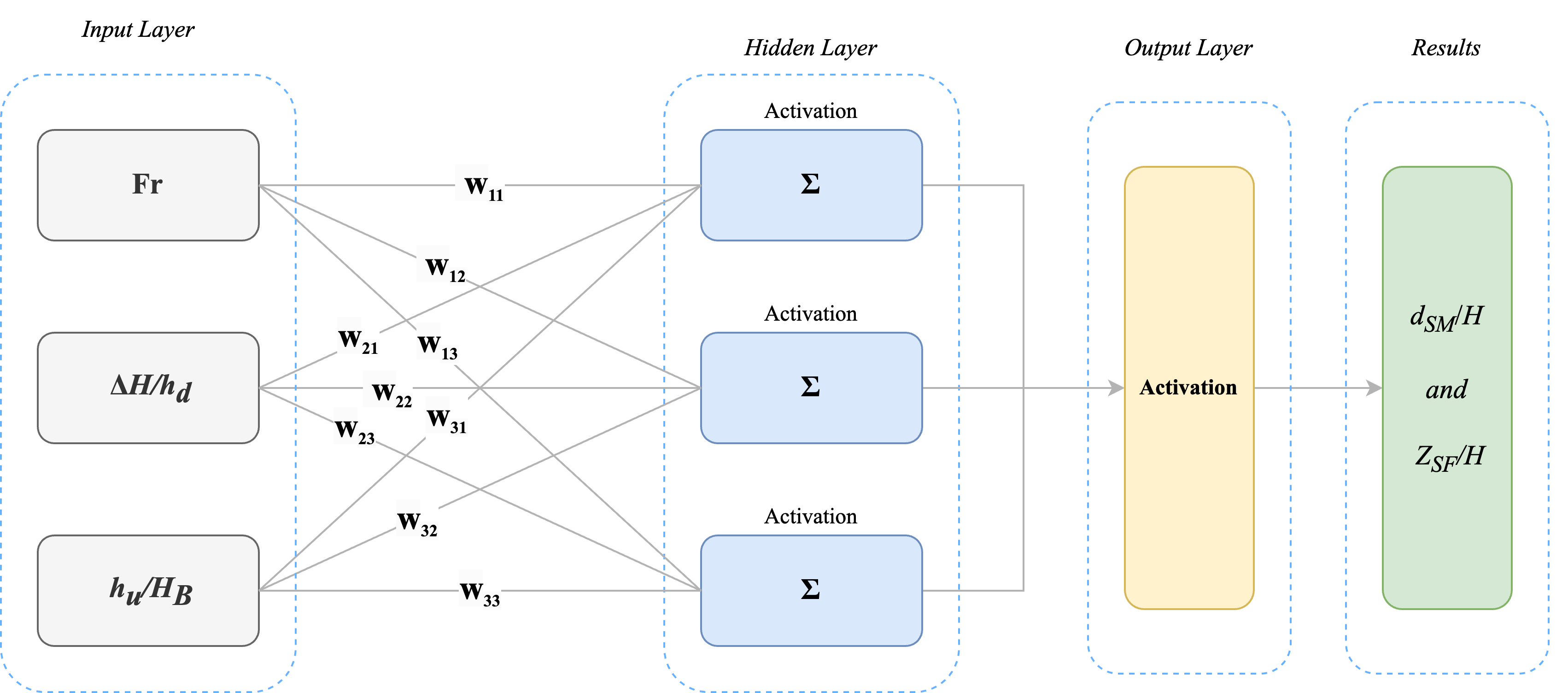
Baffle-Enhanced Scour Mitigation in Piano Key Weirs
Tarbiat Modares University, Iran (2023)
This project presents experimental and machine learning-based investigations to reduce scour downstream of rectangular and trapezoidal Piano Key Weirs (PKWs) using baffles. The inclusion of baffles significantly improved energy dissipation (by 18–22%) and reduced scour depth (by 11–14%). Machine learning models—MLP, XGBoost, and SVR—were developed to predict scour parameters, with the MLP model achieving the highest accuracy (R² = 0.988). The study also introduced new empirical equations for predicting scour, confirming the potential of baffles and data-driven modeling to enhance weir performance and structural stability.

